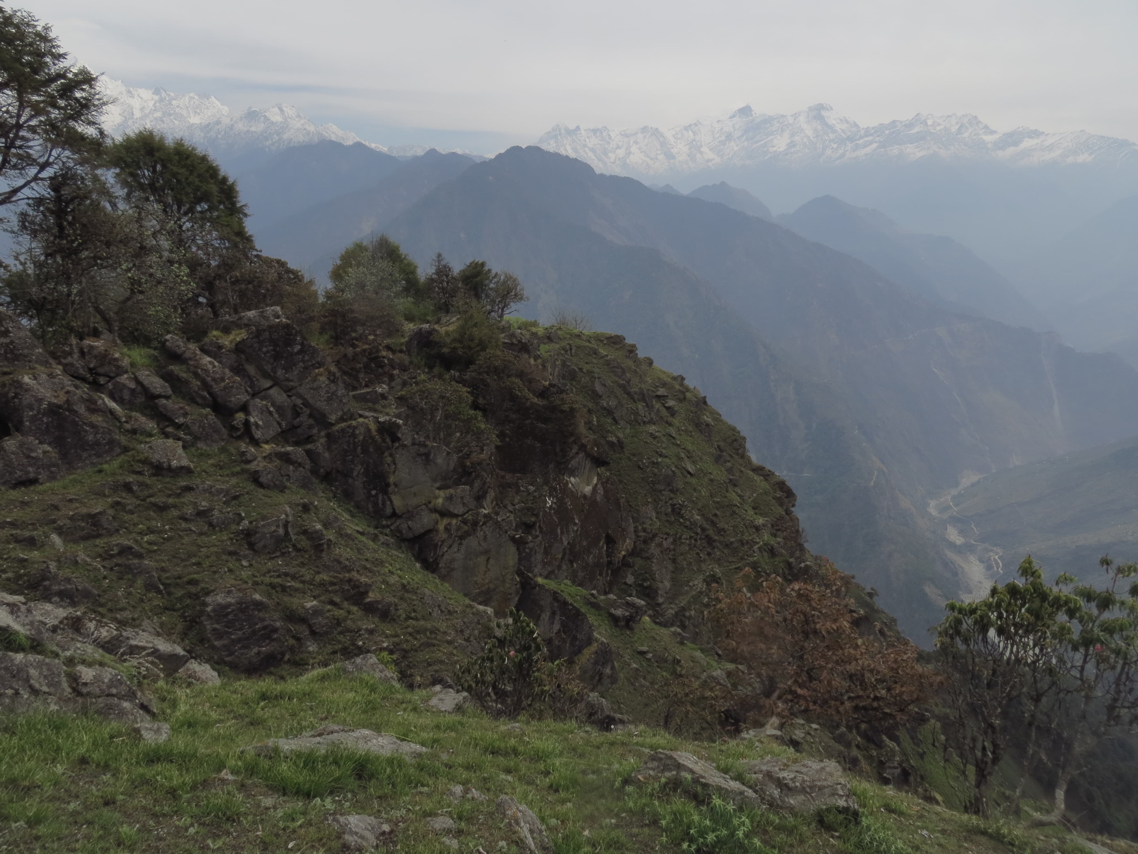
The Darma Valley is the most remote and least-visited major trek in the Kumaon Himalaya. Nine ancient villages, an Inner Line Permit zone, and direct views of the Panchachuli massif. Here is everything you need to know.
Most trekkers who come to Kumaon go to the Pindari Glacier or the Milam Valley — well-documented routes with established infrastructure. The Darma Valley, pressed against the Nepal and Tibet borders in Pithoragarh district, is a different kind of place entirely. It requires an Inner Line Permit, a 10-hour drive from Kathgodam to Dharchula, and a tolerance for genuine remoteness. In return, it offers something that is increasingly rare in the Indian Himalaya: a valley that looks almost exactly as it did a hundred years ago.
Where Is the Darma Valley?
The Darma Valley follows the Dhauli Ganga river north from Dharchula (915 m) towards the Tibet border. The total length of the inhabited valley is approximately 50 km. The valley is bounded to the east by Nepal, to the north by the Tibetan plateau, and to the west by the ridges that separate it from the Byans Valley. At its head, the Panchachuli massif — five summits from 6,312 m to 6,904 m — fills the sky.
The Nine Villages of Darma
The Darma Valley is home to nine permanent villages, all inhabited by the Raji and Shauka communities — semi-nomadic traders and herders who have worked these valleys for centuries. The villages are:
- Dar (2,134 m) — entry point to the valley, first Shauka settlement
- Sela (2,438 m) — known for its ancient stone temple and views up-valley
- Baling (2,743 m) — mid-valley hub with a small tea shop in season
- Duktu (3,048 m) — the highest inhabited village; the best base for Panchachuli views
- Nagling (2,743 m) — on the return route, slightly west of the main trail
- Bungling (2,134 m) — near the lower valley, traditional architecture intact
- Tidang, Goo, Sipu — smaller settlements with occasional seasonal occupation
The Shauka families in Darma Valley know our guides by name. In my experience, the hospitality in this valley is unlike anywhere else in the Kumaon Himalaya — partly because so few outsiders visit, and partly because the Shauka tradition of hospitality to travellers is genuinely still alive here. A cup of chai in a Darma Valley home is worth a hundred mountain hotels.
The Panchachuli Massif
The Panchachuli peaks are named after the five cooking fires of the Pandavas in Hindu mythology — the five summits representing the five Pandava brothers. From Duktu village, the highest camp on the standard Darma Valley Trek, the entire massif is visible without obstruction. Panchachuli II (6,904 m) is the highest; Rajramba (6,537 m) and Panchachuli I (6,355 m) flank it. On clear mornings, the first light catches the glacier ice on the upper faces before the rest of the valley is lit — a sight that trekkers consistently describe as the most memorable of their entire trek.
Permits Required
- Inner Line Permit (ILP) — required for all non-Uttarakhand residents; issued at Pithoragarh DM office or online
- Protected Area Permit (PAP) — required for the upper valley beyond Dharchula
- Medical fitness certificate — mandatory, stating fitness for 3,000+ m altitude
- Both permits are included and arranged in all Himalvara Darma Valley Trek packages
How to Reach Dharchula
- From Kathgodam (Haldwani): 290 km · 10–11 hours by road via Pithoragarh and Askot
- From Delhi: overnight Ranikhet Express or Kathgodam Express to Kathgodam (~7 hrs), then 10–11 hrs by road
- Himalvara packages pick up from Kathgodam and handle all transport to Dharchula and beyond
- No public air or rail service to Dharchula — road is the only access
Best Season for the Darma Valley Trek
- May–June (pre-monsoon): rhododendrons in bloom, clear skies, moderate trail conditions; best month is June
- September–October (post-monsoon): the year's sharpest mountain views, dry trail conditions, yellow birch forest; best month is October
- July–August (monsoon): valley roads are subject to landslides; the trek is not operated by Himalvara in this window
- November–April: valley access road above Dharchula closes due to snow
Difficulty and Fitness
The Darma Valley Trek is rated Challenging. Daily trekking distances range from 10–15 km with significant ascent and descent on uneven mountain trails. The maximum altitude is 4,620 m at the Panchachuli Glacier excursion point from Duktu. Prior trekking experience above 3,000 m is strongly recommended. Trekkers without previous Himalayan experience should complete at least one moderate multi-day trek (Dayara Bugyal or Gidara Bugyal level) before attempting Darma Valley.
The Darma Valley is not a place for improvised trekking. The trail beyond Baling is not marked, mobile signal is absent above Dar village, and rescue is a multi-hour operation from this zone. All Himalvara Darma Valley groups carry a satellite communicator and a high-altitude first-aid kit. We strongly recommend not attempting this route without an experienced local guide.
Vijay Singh Bisht
Founder & Lead Guide
Vijay Singh Bisht has led Darma Valley treks since 2013 — including first-ascent route surveys beyond Duktu village. He knows the valley's trails, its families, and the permit process at every level.